
Katun topographic map
Interactive map
Click on the map to display elevation.
About this map
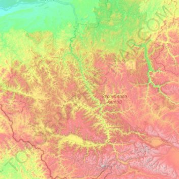
Name: Katun topographic map, elevation, terrain.
Location: Katun, Siberian Federal District, 649477, Russia (49.58626 84.97333 52.46520 86.72944)
Average elevation: 1,324 m
Minimum elevation: 144 m
Maximum elevation: 4,350 m
Other topographic maps
Click on a map to view its topography, its elevation and its terrain.
Прасковеевка
Russia > Krasnodar Krai > городской округ Геленджик > Praskoveyevka
Average elevation: 166 m
Mount Elbrus (East Summit)
Russia > Kabardino-Balkaria > Elbrus District
As Elbrus is located in the Northern Hemisphere, the summer period, the least rigorous, takes place from June to mid-September with an average of 50% of sunny days favorable to the ascent of the summit. However, the winds, dominated by westerly air masses, can turn violent and temperatures drop very quickly.…
Average elevation: 5,160 m