
Thank you for supporting this site ❤️
Make a donation
Make a donation
Byron topographic map
Click on the map to display elevation.
Thank you for supporting this site ❤️
Make a donation
Make a donation
Byron
Byron is located in Byron Township at the junction of Illinois Route 72 and Illinois Route 2. Byron's topography includes a man-made prairie and the Rock River that passes through the town. It is generally flat and is ideal for farming in most regions. According to the 2010 census, Byron has a total area of 3.572 square miles (9.25 km2), of which 3.57 square miles (9.25 km2) (or 99.94%) is land and 0.002 square miles (0.01 km2) (or 0.06%) is water.
Thank you for supporting this site ❤️
Make a donation
Make a donation
About this map
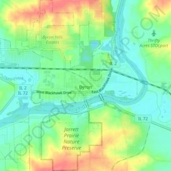
Name: Byron topographic map, elevation, terrain.
Average elevation: 226 m
Minimum elevation: 204 m
Maximum elevation: 267 m
Thank you for supporting this site ❤️
Make a donation
Make a donation