
Thank you for supporting this site ❤️
Make a donation
Make a donation
East Preston topographic map
Click on the map to display elevation.
Thank you for supporting this site ❤️
Make a donation
Make a donation
About this map
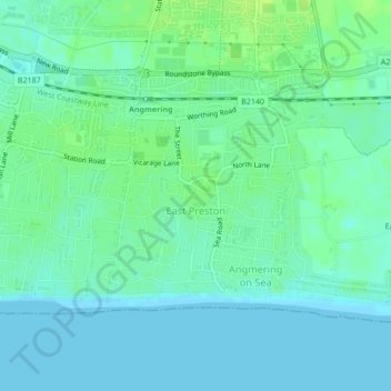
Name: East Preston topographic map, elevation, terrain.
Location: East Preston, Arun, West Sussex, England, United Kingdom (50.80186 -0.49288 50.81775 -0.46928)
Average elevation: 5 m
Minimum elevation: 0 m
Maximum elevation: 13 m
Thank you for supporting this site ❤️
Make a donation
Make a donation
Other topographic maps
Click on a map to view its topography, its elevation and its terrain.