
Thank you for supporting this site ❤️
Make a donation
Make a donation
Uepai topographic map
Click on the map to display elevation.
Thank you for supporting this site ❤️
Make a donation
Make a donation
About this map
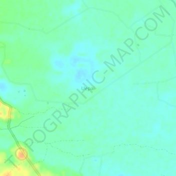
Name: Uepai topographic map, elevation, terrain.
Location: Uepai, Konawe, Southeast Sulawesi, Sulawesi, Indonesia (-4.00237 122.08219 -3.96237 122.12219)
Average elevation: 26 m
Minimum elevation: 17 m
Maximum elevation: 51 m
Thank you for supporting this site ❤️
Make a donation
Make a donation
Other topographic maps
Click on a map to view its topography, its elevation and its terrain.