
朝阳沟镇 topographic map
Interactive map
Click on the map to display elevation.
About this map
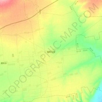
Name: 朝阳沟镇 topographic map, elevation, terrain.
Location: 朝阳沟镇, 肇州县, 大庆市, 黑龙江省, 中国 (45.66237 125.59681 45.82176 125.80045)
Average elevation: 176 m
Minimum elevation: 131 m
Maximum elevation: 226 m