
Thank you for supporting this site ❤️
Make a donation
Make a donation
Hopewell topographic map
Click on the map to display elevation.
Thank you for supporting this site ❤️
Make a donation
Make a donation
About this map
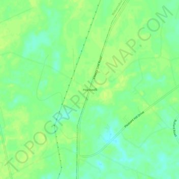
Name: Hopewell topographic map, elevation, terrain.
Location: Hopewell, Georgetown County, South Carolina, United States (33.65406 -79.43589 33.69406 -79.39589)
Average elevation: 15 m
Minimum elevation: 6 m
Maximum elevation: 21 m
Thank you for supporting this site ❤️
Make a donation
Make a donation
Other topographic maps
Click on a map to view its topography, its elevation and its terrain.
Huntington Beach State Park
United States > South Carolina > Georgetown County > Murrells Inlet
Average elevation: 2 m
Brookgreen Gardens
United States > South Carolina > Georgetown County > Murrells Inlet
Average elevation: 4 m