
Hatley topographic map
Click on the map to display elevation.
About this map
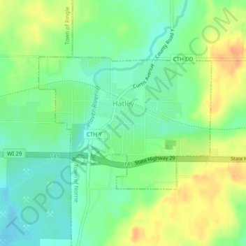
Name: Hatley topographic map, elevation, terrain.
Location: Hatley, Marathon County, Wisconsin, United States (44.87802 -89.35183 44.89260 -89.32506)
Average elevation: 393 m
Minimum elevation: 376 m
Maximum elevation: 414 m
Other topographic maps
Click on a map to view its topography, its elevation and its terrain.