
原州区 topographic map
Interactive map
Click on the map to display elevation.
About this map
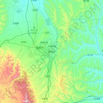
Name: 原州区 topographic map, elevation, terrain.
Location: 原州区, 南关街道, 原州区, 固原市, 宁夏回族自治区, 中国 (35.84374 106.12366 36.16374 106.44366)
Average elevation: 1,843 m
Minimum elevation: 1,547 m
Maximum elevation: 2,814 m