
Thank you for supporting this site ❤️
Make a donation
Make a donation
Jesup topographic map
Click on the map to display elevation.
Thank you for supporting this site ❤️
Make a donation
Make a donation
About this map
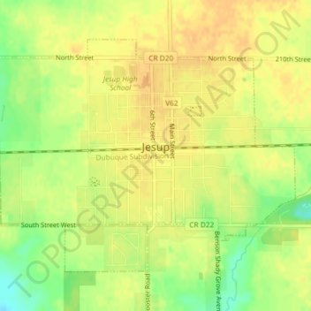
Name: Jesup topographic map, elevation, terrain.
Location: Jesup, Buchanan County, Iowa, United States (42.46410 -92.08177 42.48431 -92.04676)
Average elevation: 296 m
Minimum elevation: 275 m
Maximum elevation: 305 m
Thank you for supporting this site ❤️
Make a donation
Make a donation