
Thank you for supporting this site ❤️
Make a donation
Make a donation
Kabalukin topographic map
Click on the map to display elevation.
Thank you for supporting this site ❤️
Make a donation
Make a donation
About this map
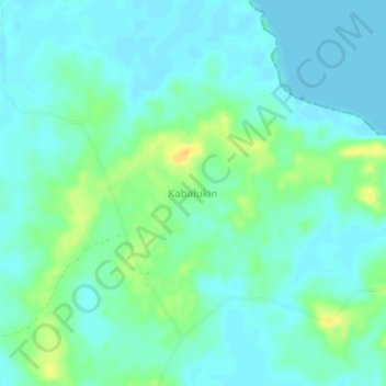
Name: Kabalukin topographic map, elevation, terrain.
Location: Kabalukin, Aru Islands, Maluku, Indonesia (-6.51245 134.10579 -6.47245 134.14579)
Average elevation: 8 m
Minimum elevation: 0 m
Maximum elevation: 28 m
Thank you for supporting this site ❤️
Make a donation
Make a donation
Other topographic maps
Click on a map to view its topography, its elevation and its terrain.