
Thank you for supporting this site ❤️
Make a donation
Make a donation
Jatirejo topographic map
Click on the map to display elevation.
Thank you for supporting this site ❤️
Make a donation
Make a donation
About this map
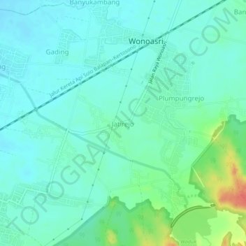
Name: Jatirejo topographic map, elevation, terrain.
Location: Jatirejo, Madiun, East Java, Java, 63151, Indonesia (-7.60082 111.59802 -7.56082 111.63802)
Average elevation: 69 m
Minimum elevation: 56 m
Maximum elevation: 111 m
Thank you for supporting this site ❤️
Make a donation
Make a donation
Other topographic maps
Click on a map to view its topography, its elevation and its terrain.