
Thank you for supporting this site ❤️
Make a donation
Make a donation
Kangayan topographic map
Click on the map to display elevation.
Thank you for supporting this site ❤️
Make a donation
Make a donation
About this map
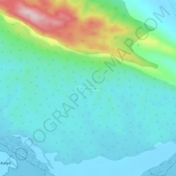
Name: Kangayan topographic map, elevation, terrain.
Location: Kangayan, Sumenep, East Java, Java, Indonesia (-6.95236 115.51866 -6.91236 115.55866)
Average elevation: 62 m
Minimum elevation: -5 m
Maximum elevation: 286 m
Thank you for supporting this site ❤️
Make a donation
Make a donation
Other topographic maps
Click on a map to view its topography, its elevation and its terrain.