
Thank you for supporting this site ❤️
Make a donation
Make a donation
River Road topographic map
Click on the map to display elevation.
Thank you for supporting this site ❤️
Make a donation
Make a donation
About this map
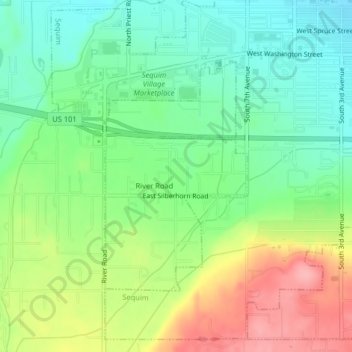
Name: River Road topographic map, elevation, terrain.
Location: River Road, Clallam County, Washington, United States (48.06148 -123.13503 48.07910 -123.11857)
Average elevation: 97 m
Minimum elevation: 53 m
Maximum elevation: 166 m
Thank you for supporting this site ❤️
Make a donation
Make a donation
Other topographic maps
Click on a map to view its topography, its elevation and its terrain.