
Thank you for supporting this site ❤️
Make a donation
Make a donation
Kanukurthy topographic map
Click on the map to display elevation.
Thank you for supporting this site ❤️
Make a donation
Make a donation
About this map
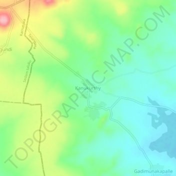
Name: Kanukurthy topographic map, elevation, terrain.
Location: Kanukurthy, Damargidda mandal, Narayanpet, Telangana, India (16.86878 77.45127 16.90878 77.49127)
Average elevation: 620 m
Minimum elevation: 574 m
Maximum elevation: 713 m
Thank you for supporting this site ❤️
Make a donation
Make a donation