
Thank you for supporting this site ❤️
Make a donation
Make a donation
Black Snake topographic map
Click on the map to display elevation.
Thank you for supporting this site ❤️
Make a donation
Make a donation
About this map
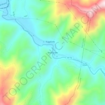
Name: Black Snake topographic map, elevation, terrain.
Location: Black Snake, Bell County, Kentucky, 40845, United States (36.74814 -83.52325 36.78814 -83.48325)
Average elevation: 508 m
Minimum elevation: 322 m
Maximum elevation: 912 m
Thank you for supporting this site ❤️
Make a donation
Make a donation
Other topographic maps
Click on a map to view its topography, its elevation and its terrain.