
Make a donation
North Chili topographic map
Click on the map to display elevation.
Make a donation
About this map
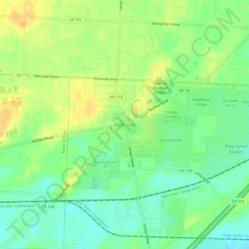
Name: North Chili topographic map, elevation, terrain.
Average elevation: 177 m
Minimum elevation: 163 m
Maximum elevation: 192 m
Make a donation
Other topographic maps
Click on a map to view its topography, its elevation and its terrain.
Crittenden Road Ball Diamonds
United States > New York > Monroe County > City of Rochester
Average elevation: 161 m
Make a donation
Make a donation
Parma Town Park
United States > New York > Monroe County > Village of Hilton > Parma Center
Average elevation: 104 m
Black Creek
United States > New York > Monroe County > Town of Brighton > Genesee Junction
Average elevation: 160 m
Make a donation
Town of Mendon
United States > New York > Monroe County
The town is bordered on the north by the town of Pittsford, on the west by the towns of Henrietta and Rush, and on the south and east by Ontario County. Honeoye Creek enters across the southern town line. The town is made up mostly of horse farms and family homes. The highest elevations in Monroe County are in…
Average elevation: 205 m