
Thank you for supporting this site ❤️
Make a donation
Make a donation
Mount Ivy topographic map
Click on the map to display elevation.
Thank you for supporting this site ❤️
Make a donation
Make a donation
Mount Ivy
The name Mount Ivy is said to have been given to the locality because of its elevation and ivy swamp.
Thank you for supporting this site ❤️
Make a donation
Make a donation
About this map
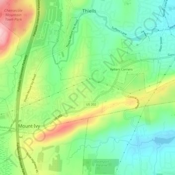
Name: Mount Ivy topographic map, elevation, terrain.
Average elevation: 123 m
Minimum elevation: 38 m
Maximum elevation: 273 m
Thank you for supporting this site ❤️
Make a donation
Make a donation
Other topographic maps
Click on a map to view its topography, its elevation and its terrain.
Kings Gate Park
United States > New York > Rockland County > Village of Montebello
Average elevation: 154 m
Evans Park Trail/Woods
United States > New York > Rockland County > Pearl River
Average elevation: 82 m
Thank you for supporting this site ❤️
Make a donation
Make a donation
Thank you for supporting this site ❤️
Make a donation
Make a donation