
Thank you for supporting this site ❤️
Make a donation
Make a donation
Lewiston topographic map
Click on the map to display elevation.
Thank you for supporting this site ❤️
Make a donation
Make a donation
About this map
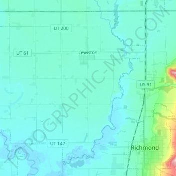
Name: Lewiston topographic map, elevation, terrain.
Location: Lewiston, Cache County, Utah, 84320, United States (41.91294 -111.94399 41.99878 -111.81197)
Average elevation: 1,376 m
Minimum elevation: 1,347 m
Maximum elevation: 1,624 m
Thank you for supporting this site ❤️
Make a donation
Make a donation
Other topographic maps
Click on a map to view its topography, its elevation and its terrain.