
Thank you for supporting this site ❤️
Make a donation
Make a donation
Londonderry topographic map
Click on the map to display elevation.
Thank you for supporting this site ❤️
Make a donation
Make a donation
About this map
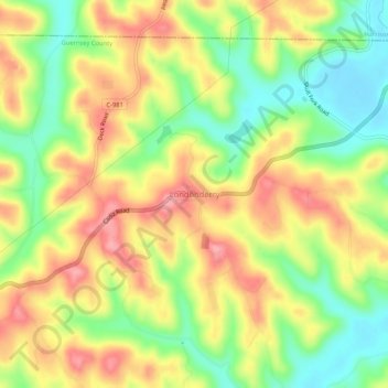
Name: Londonderry topographic map, elevation, terrain.
Location: Londonderry, Guernsey County, Ohio, 43973, United States (40.13479 -81.32039 40.17479 -81.28039)
Average elevation: 317 m
Minimum elevation: 262 m
Maximum elevation: 370 m
Thank you for supporting this site ❤️
Make a donation
Make a donation
Other topographic maps
Click on a map to view its topography, its elevation and its terrain.