
Thank you for supporting this site ❤️
Make a donation
Make a donation
Bracken Preserve topographic map
Click on the map to display elevation.
Thank you for supporting this site ❤️
Make a donation
Make a donation
About this map
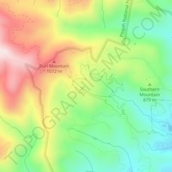
Name: Bracken Preserve topographic map, elevation, terrain.
Average elevation: 883 m
Minimum elevation: 688 m
Maximum elevation: 1,140 m
Thank you for supporting this site ❤️
Make a donation
Make a donation
Other topographic maps
Click on a map to view its topography, its elevation and its terrain.
Thank you for supporting this site ❤️
Make a donation
Make a donation
Thank you for supporting this site ❤️
Make a donation
Make a donation
Thank you for supporting this site ❤️
Make a donation
Make a donation
Thank you for supporting this site ❤️
Make a donation
Make a donation
Franklin Park
United States > North Carolina > Transylvania County > Brevard > Franklin Park
Average elevation: 665 m
Line Runner Ridge
United States > North Carolina > Transylvania County > Line Runner Ridge
Average elevation: 822 m