
Thank you for supporting this site ❤️
Make a donation
Make a donation
Mantua Township topographic map
Click on the map to display elevation.
Thank you for supporting this site ❤️
Make a donation
Make a donation
About this map
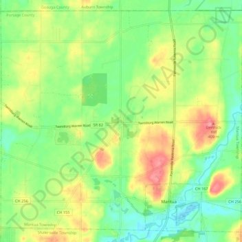
Name: Mantua Township topographic map, elevation, terrain.
Location: Mantua Township, Portage County, Ohio, 44255, United States (41.27382 -81.29856 41.34758 -81.19129)
Average elevation: 358 m
Minimum elevation: 325 m
Maximum elevation: 405 m
Thank you for supporting this site ❤️
Make a donation
Make a donation
Other topographic maps
Click on a map to view its topography, its elevation and its terrain.