
Thank you for supporting this site ❤️
Make a donation
Make a donation
Choeng Thale topographic map
Click on the map to display elevation.
Thank you for supporting this site ❤️
Make a donation
Make a donation
About this map
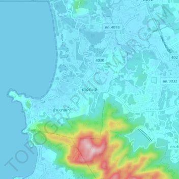
Name: Choeng Thale topographic map, elevation, terrain.
Location: Choeng Thale, Si Sunthon, Phuket Province, 83110, Thailand (7.94905 98.26702 8.02905 98.34702)
Average elevation: 57 m
Minimum elevation: 0 m
Maximum elevation: 503 m
Thank you for supporting this site ❤️
Make a donation
Make a donation