Geolocate

Barberton topographic map

Click on the map to display elevation.

About this map

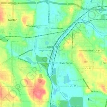
Name: Barberton topographic map, elevation, terrain.

Location: Barberton, Summit County, Ohio, 44203, United States (40.97592 -81.65065 41.04131 -81.56390)

Average elevation: 312 m

Minimum elevation: 287 m

Maximum elevation: 359 m

Other topographic maps

Click on a map to view its topography, its elevation and its terrain.

Metz

United States > Ohio > Summit County > Stow

Average elevation: 318 m

Sagamore Hills

United States > Ohio > Summit County

Average elevation: 264 m

Maple Grove Park

United States > Ohio > Summit County > Hudson

Average elevation: 316 m

Copley

United States > Ohio > Summit County

Average elevation: 318 m

Boston

United States > Ohio > Summit County

Average elevation: 245 m

Myersville

United States > Ohio > Summit County > Green

Average elevation: 342 m

Decker Park

United States > Ohio > Summit County > Barberton

Average elevation: 304 m

Metz

United States > Ohio > Summit County > Stow

Average elevation: 318 m