
Thank you for supporting this site ❤️
Make a donation
Make a donation
Kodencherry topographic map
Click on the map to display elevation.
Thank you for supporting this site ❤️
Make a donation
Make a donation
About this map
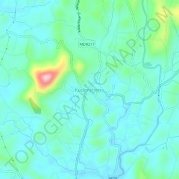
Name: Kodencherry topographic map, elevation, terrain.
Location: Kodencherry, Thamarassery, Kozhikode, Kerala, 673580, India (11.41210 75.98566 11.45210 76.02566)
Average elevation: 65 m
Minimum elevation: 20 m
Maximum elevation: 263 m
Thank you for supporting this site ❤️
Make a donation
Make a donation
Other topographic maps
Click on a map to view its topography, its elevation and its terrain.