
Thank you for supporting this site ❤️
Make a donation
Make a donation
Kamand topographic map
Click on the map to display elevation.
Thank you for supporting this site ❤️
Make a donation
Make a donation
About this map
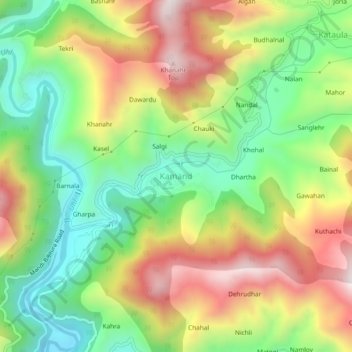
Name: Kamand topographic map, elevation, terrain.
Location: Kamand, Mandi, Himachal Pradesh, 175075, India (31.76172 76.97736 31.80172 77.01736)
Average elevation: 1,259 m
Minimum elevation: 938 m
Maximum elevation: 1,666 m
Thank you for supporting this site ❤️
Make a donation
Make a donation
Other topographic maps
Click on a map to view its topography, its elevation and its terrain.