
Thank you for supporting this site ❤️
Make a donation
Make a donation
Nibley topographic map
Click on the map to display elevation.
Thank you for supporting this site ❤️
Make a donation
Make a donation
About this map
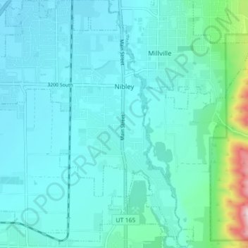
Name: Nibley topographic map, elevation, terrain.
Location: Nibley, Cache County, Utah, United States (41.64027 -111.87868 41.69290 -111.81344)
Average elevation: 1,428 m
Minimum elevation: 1,363 m
Maximum elevation: 1,857 m
Thank you for supporting this site ❤️
Make a donation
Make a donation
Other topographic maps
Click on a map to view its topography, its elevation and its terrain.