Medulla topographic map
Interactive map
Click on the map to display elevation.
About this map
![Medulla topographic map, elevation, terrain](/pub/maps/way/7v3l/wmpzxnx/thumbnail.jpg)
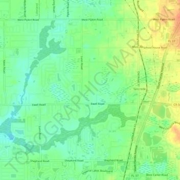
Name: Medulla topographic map, elevation, terrain.
Location: Medulla, Lakeland, Polk County, Florida, United States (27.93846 -82.01265 27.97485 -81.96018)
Average elevation: 43 m
Minimum elevation: 26 m
Maximum elevation: 66 m
Other topographic maps
Click on a map to view its topography, its elevation and its terrain.
![Dobbins Park topographic map, elevation, terrain](/pub/maps/way/k1tf/2jjpv57/icon.jpg)
Dobbins Park
United States > Florida > Polk County > Lakeland
Dobbins Park, Lakeland, Polk County, Florida, United States
Average elevation: 58 m
![Lakeland topographic map, elevation, terrain](/pub/maps/node/n18/3kjqtdn/icon.jpg)
Lakeland
United States > Florida > Polk County > Lakeland
Lakeland, Polk County, Florida, 33081, United States
Average elevation: 42 m
![Fountain Heights topographic map, elevation, terrain](/pub/maps/node/w5b3/wc854tf/icon.jpg)
Fountain Heights
United States > Florida > Polk County > Lakeland > Fountain Heights
Fountain Heights, Lakeland, Polk County, Florida, 33803, United States
Average elevation: 53 m