
Thank you for supporting this site ❤️
Make a donation
Make a donation
Nièvre topographic map
Click on the map to display elevation.
Thank you for supporting this site ❤️
Make a donation
Make a donation
About this map
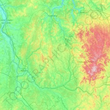
Name: Nièvre topographic map, elevation, terrain.
Location: Nièvre, Bourgogne-Franche-Comté, Metropolitan France, France (46.65102 2.84448 47.58834 4.23179)
Average elevation: 284 m
Minimum elevation: 125 m
Maximum elevation: 899 m
Thank you for supporting this site ❤️
Make a donation
Make a donation