
Thank you for supporting this site ❤️
Make a donation
Make a donation
Ariel topographic map
Click on the map to display elevation.
Thank you for supporting this site ❤️
Make a donation
Make a donation
About this map
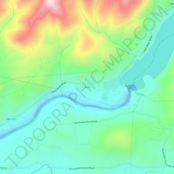
Name: Ariel topographic map, elevation, terrain.
Location: Ariel, Cowlitz County, Washington, United States (45.93678 -122.59093 45.97678 -122.55093)
Average elevation: 206 m
Minimum elevation: 12 m
Maximum elevation: 662 m
Thank you for supporting this site ❤️
Make a donation
Make a donation
Other topographic maps
Click on a map to view its topography, its elevation and its terrain.