
Thank you for supporting this site ❤️
Make a donation
Make a donation
Bantargebang topographic map
Click on the map to display elevation.
Thank you for supporting this site ❤️
Make a donation
Make a donation
About this map
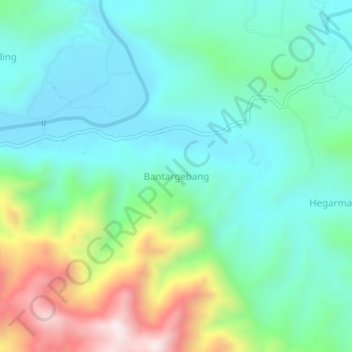
Name: Bantargebang topographic map, elevation, terrain.
Location: Bantargebang, Sukabumi, West Java, Java, Indonesia (-7.04893 106.65995 -7.00893 106.69995)
Average elevation: 226 m
Minimum elevation: 33 m
Maximum elevation: 742 m
Thank you for supporting this site ❤️
Make a donation
Make a donation