
Thank you for supporting this site ❤️
Make a donation
Make a donation
Walters topographic map
Click on the map to display elevation.
Thank you for supporting this site ❤️
Make a donation
Make a donation
About this map
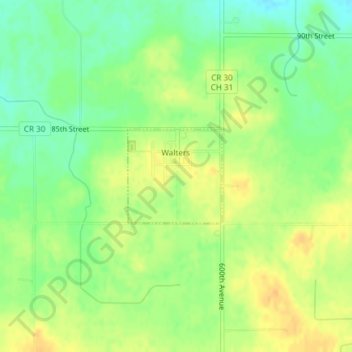
Name: Walters topographic map, elevation, terrain.
Location: Walters, Faribault County, Minnesota, United States (43.60108 -93.67839 43.60834 -93.66838)
Average elevation: 376 m
Minimum elevation: 360 m
Maximum elevation: 389 m
Thank you for supporting this site ❤️
Make a donation
Make a donation
Other topographic maps
Click on a map to view its topography, its elevation and its terrain.