
Thank you for supporting this site ❤️
Make a donation
Make a donation
Westville topographic map
Click on the map to display elevation.
Thank you for supporting this site ❤️
Make a donation
Make a donation
About this map
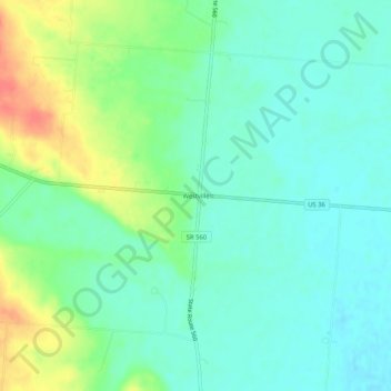
Name: Westville topographic map, elevation, terrain.
Location: Westville, Champaign County, Ohio, 43083, United States (40.08950 -83.85799 40.12950 -83.81799)
Average elevation: 315 m
Minimum elevation: 298 m
Maximum elevation: 351 m
Thank you for supporting this site ❤️
Make a donation
Make a donation
Other topographic maps
Click on a map to view its topography, its elevation and its terrain.