
Thank you for supporting this site ❤️
Make a donation
Make a donation
Geger topographic map
Click on the map to display elevation.
Thank you for supporting this site ❤️
Make a donation
Make a donation
About this map
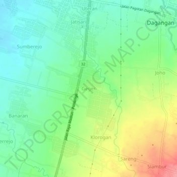
Name: Geger topographic map, elevation, terrain.
Location: Geger, Madiun, East Java, Java, 63173, Indonesia (-7.74504 111.51626 -7.70504 111.55626)
Average elevation: 113 m
Minimum elevation: 80 m
Maximum elevation: 171 m
Thank you for supporting this site ❤️
Make a donation
Make a donation
Other topographic maps
Click on a map to view its topography, its elevation and its terrain.