
Thank you for supporting this site ❤️
Make a donation
Make a donation
Nagrota Nahan topographic map
Click on the map to display elevation.
Thank you for supporting this site ❤️
Make a donation
Make a donation
About this map
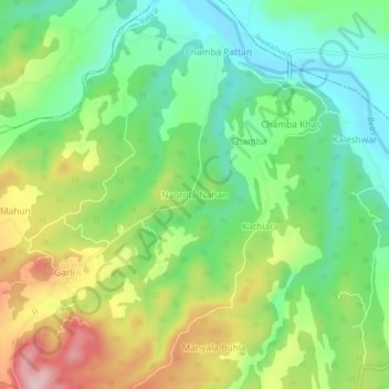
Name: Nagrota Nahan topographic map, elevation, terrain.
Location: Nagrota Nahan, Rakkar, Kangra, Himachal Pradesh, 177108, India (31.79657 76.23125 31.83657 76.27125)
Average elevation: 512 m
Minimum elevation: 421 m
Maximum elevation: 659 m
Thank you for supporting this site ❤️
Make a donation
Make a donation