
Thank you for supporting this site ❤️
Make a donation
Make a donation
Mount Sanford topographic map
Click on the map to display elevation.
Thank you for supporting this site ❤️
Make a donation
Make a donation
About this map
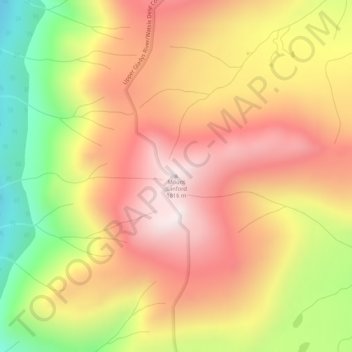
Name: Mount Sanford topographic map, elevation, terrain.
Location: Mount Sanford, Stikine Region, British Columbia, Canada (59.49186 -132.82310 59.49196 -132.82300)
Average elevation: 1,510 m
Minimum elevation: 1,097 m
Maximum elevation: 1,816 m
Thank you for supporting this site ❤️
Make a donation
Make a donation
Other topographic maps
Click on a map to view its topography, its elevation and its terrain.