
Thank you for supporting this site ❤️
Make a donation
Make a donation
Bertem topographic map
Click on the map to display elevation.
Thank you for supporting this site ❤️
Make a donation
Make a donation
About this map
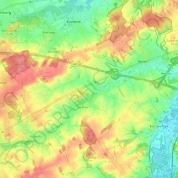
Name: Bertem topographic map, elevation, terrain.
Location: Bertem, Leuven, Flemish Brabant, Flanders, Belgium (50.81839 4.54618 50.89097 4.66000)
Average elevation: 64 m
Minimum elevation: 21 m
Maximum elevation: 111 m
Thank you for supporting this site ❤️
Make a donation
Make a donation
Other topographic maps
Click on a map to view its topography, its elevation and its terrain.