
Thank you for supporting this site ❤️
Make a donation
Make a donation
Hanging Rock topographic map
Click on the map to display elevation.
Thank you for supporting this site ❤️
Make a donation
Make a donation
About this map
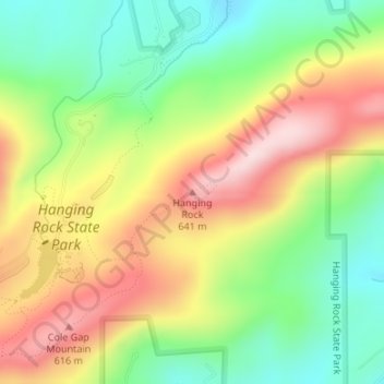
Name: Hanging Rock topographic map, elevation, terrain.
Location: Hanging Rock, Stokes County, North Carolina, United States (36.39592 -80.25621 36.39602 -80.25611)
Average elevation: 461 m
Minimum elevation: 312 m
Maximum elevation: 641 m
Thank you for supporting this site ❤️
Make a donation
Make a donation