
Thank you for supporting this site ❤️
Make a donation
Make a donation
Jilin City topographic map
Click on the map to display elevation.
Thank you for supporting this site ❤️
Make a donation
Make a donation
About this map
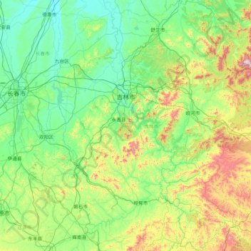
Name: Jilin City topographic map, elevation, terrain.
Location: Jilin City, Jilin, China (42.55877 125.63987 44.64608 127.91890)
Average elevation: 375 m
Minimum elevation: 154 m
Maximum elevation: 1,655 m
Thank you for supporting this site ❤️
Make a donation
Make a donation
Other topographic maps
Click on a map to view its topography, its elevation and its terrain.