
Thank you for supporting this site ❤️
Make a donation
Make a donation
Matiyal topographic map
Click on the map to display elevation.
Thank you for supporting this site ❤️
Make a donation
Make a donation
About this map
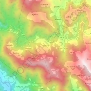
Name: Matiyal topographic map, elevation, terrain.
Location: Matiyal, Dhari, Nainital, Uttarakhand, India (29.35681 79.59104 29.39681 79.63104)
Average elevation: 1,726 m
Minimum elevation: 1,202 m
Maximum elevation: 2,128 m
Thank you for supporting this site ❤️
Make a donation
Make a donation