
Thank you for supporting this site ❤️
Make a donation
Make a donation
A Madanela topographic map
Click on the map to display elevation.
Thank you for supporting this site ❤️
Make a donation
Make a donation
About this map
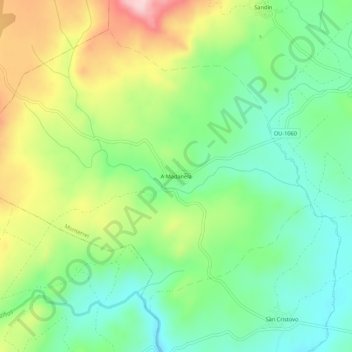
Name: A Madanela topographic map, elevation, terrain.
Location: A Madanela, Monterrei, Verín, Orense, Galicia, 32618, España (41.89731 -7.60679 41.93731 -7.56679)
Average elevation: 693 m
Minimum elevation: 607 m
Maximum elevation: 839 m
Thank you for supporting this site ❤️
Make a donation
Make a donation
Other topographic maps
Click on a map to view its topography, its elevation and its terrain.