
Bellevue topographic map
Click on the map to display elevation.
About this map
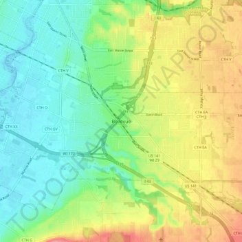
Name: Bellevue topographic map, elevation, terrain.
Location: Bellevue, Brown County, Wisconsin, 54311, United States (44.42389 -87.99430 44.50389 -87.91430)
Average elevation: 211 m
Minimum elevation: 177 m
Maximum elevation: 265 m