
Thank you for supporting this site ❤️
Make a donation
Make a donation
Jatijajar topographic map
Click on the map to display elevation.
Thank you for supporting this site ❤️
Make a donation
Make a donation
About this map
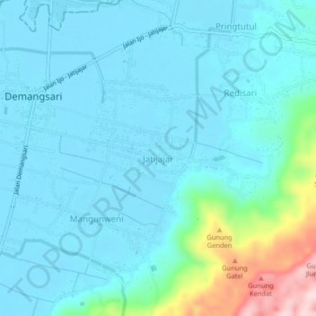
Name: Jatijajar topographic map, elevation, terrain.
Location: Jatijajar, Kebumen, Central Java, Java, Indonesia (-7.68757 109.39993 -7.64757 109.43993)
Average elevation: 52 m
Minimum elevation: 1 m
Maximum elevation: 345 m
Thank you for supporting this site ❤️
Make a donation
Make a donation