
张家口市 topographic map
Interactive map
Click on the map to display elevation.
About this map
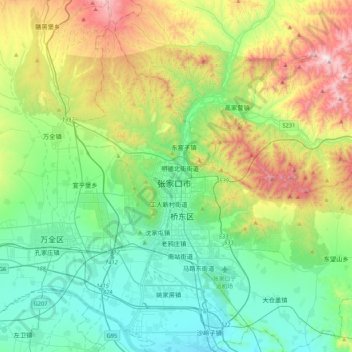
Name: 张家口市 topographic map, elevation, terrain.
Location: 张家口市, 桥西区, 张家口市, 河北省, 075000, 中国 (40.66280 114.72057 40.98280 115.04057)
Average elevation: 959 m
Minimum elevation: 633 m
Maximum elevation: 1,764 m
位于蔚县、涿鹿交界处的小五台山平均海拔2000米,其中主峰东台最高,达2882米,为河北省最高峰。
Other topographic maps
Click on a map to view its topography, its elevation and its terrain.