
Le Hammer topographic map
Interactive map
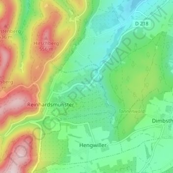
Click on the map to display elevation.
About this map
Name: Le Hammer topographic map, elevation, terrain.
Average elevation: 352 m
Minimum elevation: 219 m
Maximum elevation: 595 m
Other topographic maps
Click on a map to view its topography, its elevation and its terrain.
Haberacker
France > Grand Est > Bas-Rhin > Reinhardsmunster
Haberacker, Reinhardsmunster, Saverne, Bas-Rhin, Grand Est, France métropolitaine, 67440, France
Average elevation: 434 m