
Thank you for supporting this site ❤️
Make a donation
Make a donation
Odessa topographic map
Click on the map to display elevation.
Thank you for supporting this site ❤️
Make a donation
Make a donation
About this map
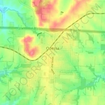
Name: Odessa topographic map, elevation, terrain.
Location: Odessa, Lafayette County, Missouri, United States (38.97862 -93.99833 39.01633 -93.93628)
Average elevation: 277 m
Minimum elevation: 241 m
Maximum elevation: 319 m
Thank you for supporting this site ❤️
Make a donation
Make a donation
Other topographic maps
Click on a map to view its topography, its elevation and its terrain.