
Thank you for supporting this site ❤️
Make a donation
Make a donation
Ankeny topographic map
Click on the map to display elevation.
Thank you for supporting this site ❤️
Make a donation
Make a donation
Ankeny
Like most of Polk County, Ankeny exists at the bottom area of the Des Moines Lobe, a topographical landscape area, in an area known as the Bemis Advance. The Lobe was formed during the Wisconsin glaciation leaving significant deposits resulting in an area with low relief.
Thank you for supporting this site ❤️
Make a donation
Make a donation
About this map
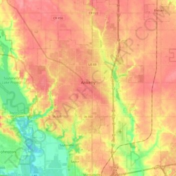
Name: Ankeny topographic map, elevation, terrain.
Location: Ankeny, Polk County, Iowa, United States (41.65213 -93.67277 41.80218 -93.54144)
Average elevation: 284 m
Minimum elevation: 237 m
Maximum elevation: 314 m
Thank you for supporting this site ❤️
Make a donation
Make a donation