
Appel topographic map
Interactive map
Click on the map to display elevation.
About this map
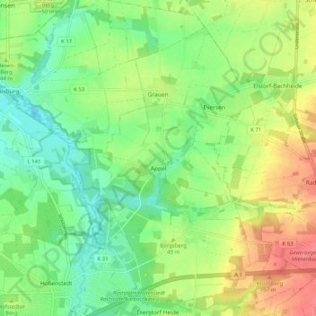
Name: Appel topographic map, elevation, terrain.
Location: Appel, Samtgemeinde Hollenstedt, Harburg, Nedersaksen, Duitsland (53.36213 9.72313 53.42229 9.78167)
Average elevation: 40 m
Minimum elevation: 8 m
Maximum elevation: 88 m
Other topographic maps
Click on a map to view its topography, its elevation and its terrain.
Stelle
Duitsland > Nedersaksen > Harburg
Stelle, Harburg, Nedersaksen, 21435, Duitsland
Average elevation: 13 m