
Thank you for supporting this site ❤️
Make a donation
Make a donation
Gunung Jati topographic map
Click on the map to display elevation.
Thank you for supporting this site ❤️
Make a donation
Make a donation
About this map
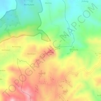
Name: Gunung Jati topographic map, elevation, terrain.
Location: Gunung Jati, Semarang, Central Java, Java, Indonesia (-7.26644 110.62995 -7.26634 110.63005)
Average elevation: 228 m
Minimum elevation: 109 m
Maximum elevation: 353 m
Thank you for supporting this site ❤️
Make a donation
Make a donation
Other topographic maps
Click on a map to view its topography, its elevation and its terrain.