
Thank you for supporting this site ❤️
Make a donation
Make a donation
Cathedral City topographic map
Click on the map to display elevation.
Thank you for supporting this site ❤️
Make a donation
Make a donation
About this map
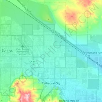
Name: Cathedral City topographic map, elevation, terrain.
Average elevation: 169 m
Minimum elevation: 60 m
Maximum elevation: 662 m
Thank you for supporting this site ❤️
Make a donation
Make a donation
Other topographic maps
Click on a map to view its topography, its elevation and its terrain.
Temescal Creek
United States > California > Riverside County > Temescal Valley
Average elevation: 317 m