
Thank you for supporting this site ❤️
Make a donation
Make a donation
Semiring topographic map
Click on the map to display elevation.
Thank you for supporting this site ❤️
Make a donation
Make a donation
About this map
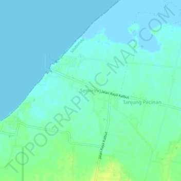
Name: Semiring topographic map, elevation, terrain.
Location: Semiring, Situbondo, East Java, Java, Indonesia (-7.65028 114.00184 -7.61028 114.04184)
Average elevation: 4 m
Minimum elevation: -2 m
Maximum elevation: 15 m
Thank you for supporting this site ❤️
Make a donation
Make a donation